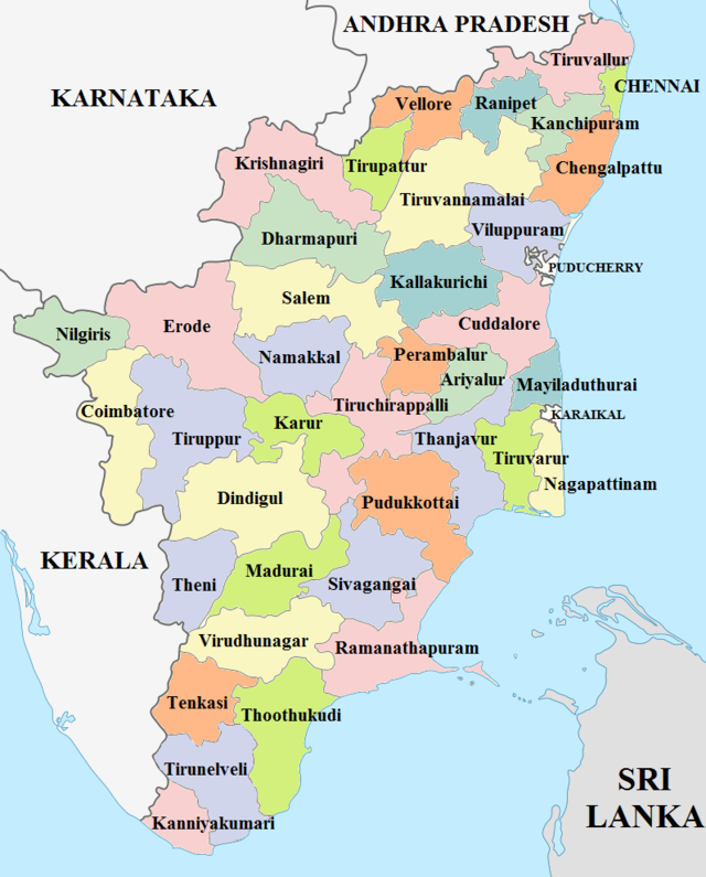
DISTRICTS in TAMIL NADU
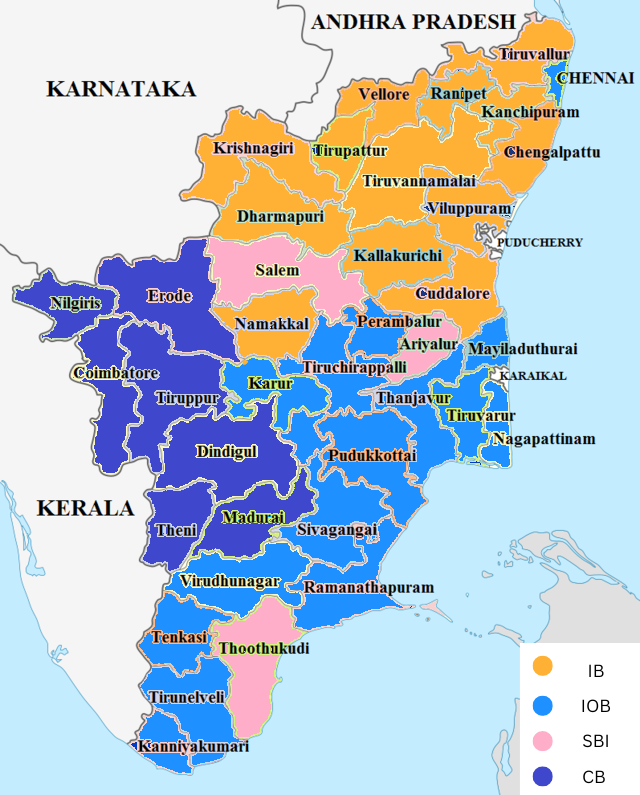
LEAD DISTRICT BANKS in TAMIL NADU
Geographical Location
North Latitude Between 8° 5' and 13° 35'
East Longitude Between 76° 15' and 80° 20'
Geography of Tamil nadu
Tamil Nadu covers an area of 130,058 km2 (50,216 sq mi), and is the eleventh largest state in India. The bordering states are Kerala to the west, Karnataka to the north west and Andhra Pradesh to the north. To the east is the Bay of Bengal and the union territory of Puducherry. The southernmost tip of the Indian Peninsula is located in Tamil Nadu. At this point is the town of Kanyakumari which is the meeting point of the Arabian Sea, the Bay of Bengal, and the Indian Ocean. The south boundary of India is Kanyakumari, Tamil Nadu.
Topographic map of Tamil Nadu
The western, southern and the north western parts are hilly and rich in vegetation. The Western Ghats and the Eastern Ghats and they both meet at the Nilgiri hills. The Western Ghats dominate the entire western border with Kerala, effectively blocking much of the rain bearing clouds of the south west monsoon from entering the state. The eastern parts are fertile coastal plains and the northern parts are a mix of hills and plains. The central and the south central regions are arid plains and receive less rainfall than the other regions.
Tamil Nadu has a coastline of about 910 km (570 mi) which is the country’s third longest coastline. Tamil Nadu's coastline bore the brunt of the 2004Indian Ocean Tsunami when it hit India, which caused 7,793 direct deaths in the state. Tamil Nadu falls mostly in a region of low seismic hazard with the exception of the western border areas that lie in a low to moderate hazard zone; as per the 2002 Bureau of Indian Standards (BIS) map, Tamil Nadu falls in Zones II & III. Historically, parts of this region have experienced seismic activity in the M5.0 range.